Advice for those flying to Pavullo
This mini-guide does not replace the AIP or any official publication.
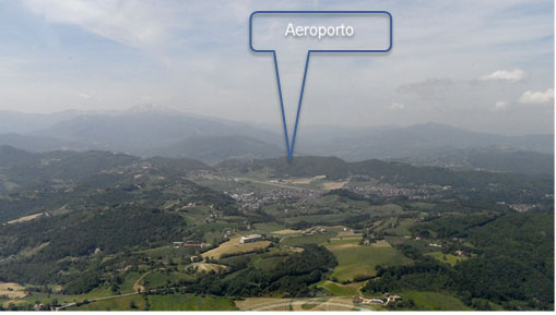
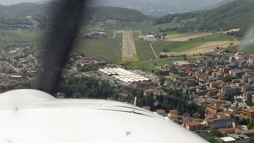
- Pavullo airport is open from sunrise to sunset HJ-/+30
- The altitude of the runway is: 2,245 ft AMSL
- The coordinates are: 44° 19′ 20″ North 10° 49′ 54″ East
- The radio frequency in use is: 124.980
- The radio call is mandatory, communications must be short and essential.
- Pavullo does not have an ATS nor ATC service. The pilots in command are the sole responsible for their operations.
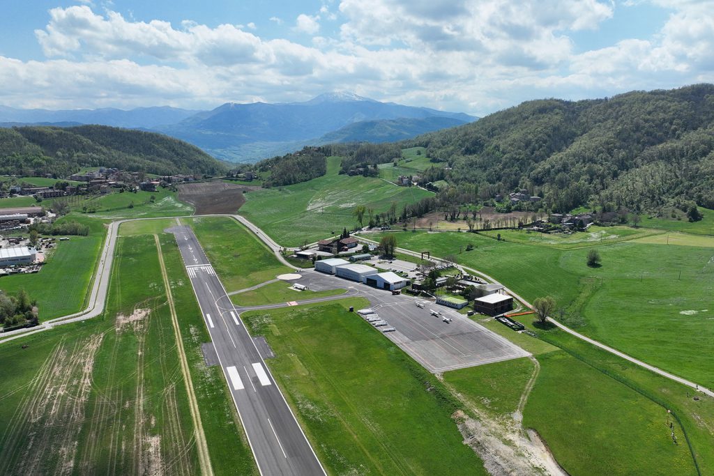
- The runway has a gentle slope, descending to the North: Heading 02 is at 2255ft, Heading 20 is at 2223ft.
- For take-offs, if allowed by wind conditions, runway 02 is much preferable.
- The landing for runway 02 involves the base in a fork, nothing particularly difficult, but not to be taken lightly either, the procedure is very similar to that of Marina di Campo for runway 16.
- The landing for runway 20 is trivial, and given the slight climb it is feasible even with a light tailwind.
Taxiing
- Taxiing is permitted only on the runway and on the taxiways.
- During events it is possible to clear the track at any point, as it is coplanar with the contiguous grass safety strips, meaning there is no step. Marshalls will also be present along the track for assistance.
Approach and Circuit
- Approaching aircraft will have to keep out of the Bologna CTR or in contact with it, strictly respecting the entry routes.
- Entry points vary depending on the runway in use, and the latter will be communicated by the Pavullo radio operator. At entry points, pilots should pay close attention to any other oncoming traffic.
- The circuit is standard, i.e. LEFT for both runways (02-20), in most cases the runway in use is 02.
- Once you enter a long downwind, maintain a distance of 800/1000 m between you and the runway axis, at an elevation of about 3,600 ft on the H that should provide you with a runway view.
- If you should find yourself in the downwind line for landing, you should maintain a distance of at least 500/600 meters from those ahead of you and, as far as possible, a speed compatible with any slow aircraft ahead of you. Therefore, expect to have to extend such downwind in case of heavy traffic to the river below. In case of go around, follow the left circuit.
Approach speed
Fast aircrafts are requested to slow down and, if possible, maintain a speed NOT exceeding 70 knots (130 km/h). On the contrary, pilots of slow aircrafts are asked to increase their speed (with judgment) and, if possible, approach said speed. No overtaking is allowed after the entry points.
Procedure for RWY 02 (landing with North heading, most likely).
Approach and Circuit
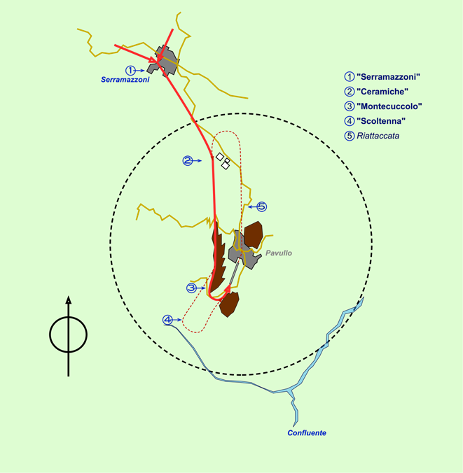
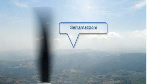
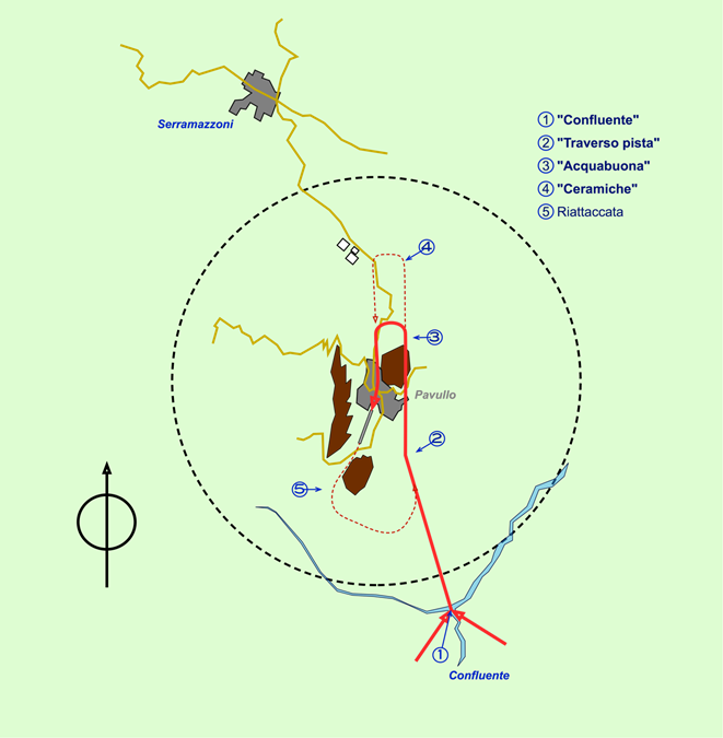
- The entry point is Point 1 immediately south of the city of Serramazzoni.
- Sexagesimal coordinates 44° 25′ 30 “N 10° 46′ 48 “E
- Coordinates to first decimal places 44° 25.5’N 10° 46.8’E
- Entry altitude 3600ft on the QNH
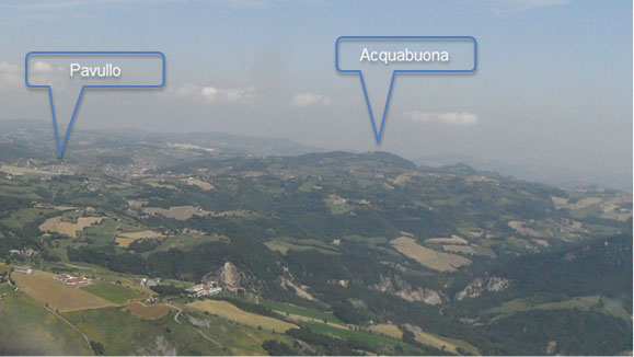
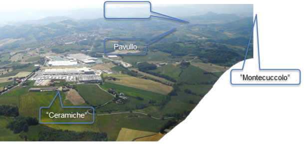
- Point 2 (Ceramics) are some very visible factories, keeping them under the left wing, make heading 180 and head for the ridge in front of you, which you will also keep under the left wing. In this way you can see the runway and have ample space and altitude to your right.
- In zone 3, adjust your descent in relation to the terrain and traffic; if you do not think the distance from those ahead of you is sufficient, lengthen the downwind as indicated in step 4.
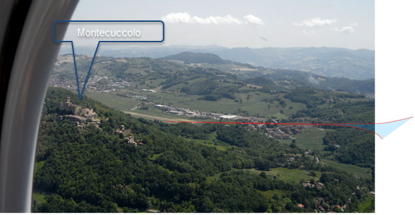
- At discretion turn left for base-final inserting into the Amola saddle (the runway is initially only partly visible)
Takeoff
- Proceed along the runway axis and on the Pavullo vertical proceed with North heading.
- To leave the area, you cannot turn left until you have passed Serramazzoni, which you must leave on your left.
Go around (5)
- If you had to go around, proceed as for takeoff and pay close attention to incoming traffic. Reinsert only when you have sufficient space; do not cut anyone off.
- If there is heavy traffic accept the idea of even going as far as Serramazzoni.
Procedure for RWY 20 (landing with heading south).
Approach and Circuit
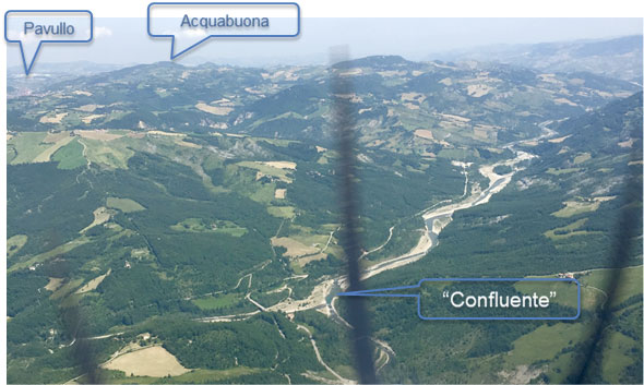
- Point 1 is on the vertical of the Panaro confluent
- Entry altitude 3600ft on the QNH
- Sexagesimal coordinates 44° 16′ 06 “N 10° 52′ 42 “E
- Coordinates to first decimal places 44° 16.1’N 10° 52.7’E
- Entry altitude 3600ft on the QNH
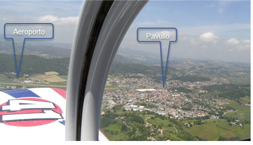
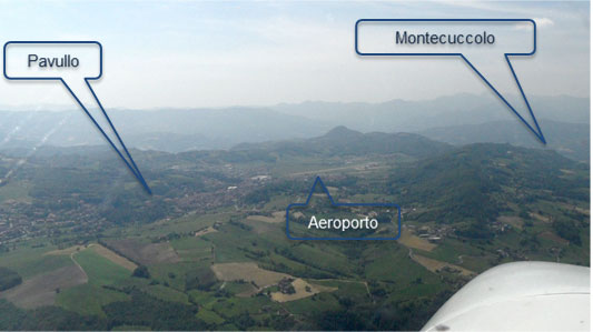
- Point 2 is the traverse of the 02 runway head, from here head north heading toward the eastern part of Pavullo whose center you will keep well in view on the left.
- In step 3, adjust your descent in relation to the terrain and traffic; if you do not think the distance from those ahead is sufficient, lengthen the downwind as indicated (step 4).
- Turn according to discretion, but be sure that there is sufficient space between you and those ahead of you.
Takeoff
- As soon as you take off, turn slightly to the right and proceed with a southwest bow toward the Amola saddle.
- To leave the area, you cannot turn left until you have passed the Confluent, which you must leave on your left.
Go around (5)
- If you had to go around, proceed same as takeoff and pay close attention to incoming traffic. Reinsert only when there is sufficient space; do not cut anyone off.
- If there is heavy traffic accept the idea of even going as far as the Confluent.